Hyderabad Master Plan 2050: How 3D Digital Twin Tech Will Shape the City’s Future
Hyderabad’s 2050 Master Plan will map the city in 3D. Could this digital twin be the key to a smarter, greener future?
 Admin
Admin

Hyderabad is getting ready for a new kind of master plan. HMDA has begun work on a single, citywide blueprint that runs up to the proposed Regional Ring Road and replaces the patchwork of existing plans. IIT Hyderabad is on board as the technical partner, bringing geospatial and digital twin expertise to the table.
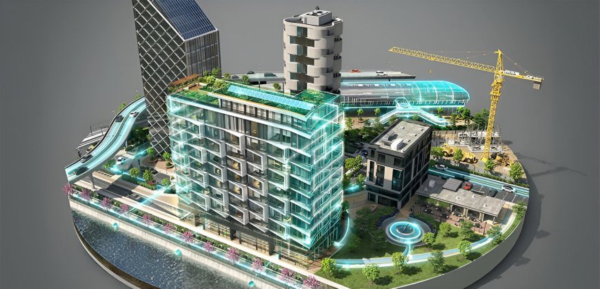
The backbone of this effort is a 3D digital twin of the metropolitan area up to the Outer Ring Road. The model will be built from LiDAR surveys and high-precision mapping, so planners see not only length and width but also height across the city. The goal is simple. Put a precise, living picture of Hyderabad on every planner’s screen and cut guesswork from decisions.
Three linked plans have already moved ahead. A Comprehensive Mobility Plan to raise the share of public transport. An Economic Development Plan to shape logistics hubs, business corridors, and industrial growth. A Blue-Green Plan to protect water bodies, increase tree cover, and set clear environmental safeguards. These are being folded into the final 2050 document.
Hyderabad’s Digital Twin Ready to Transform City Operations
Real-time layers turn the map into an operating system for the city. Flood risk can be modeled street by street before the first cloudburst. Traffic flow can be read where it happens and signal plans can adjust faster. Utility teams can check alignments, plan trenches, and reduce rework. The same base map helps every department speak one language.
Hyderabad is not starting from scratch. IIIT Hyderabad’s Smart City Living Lab has already built and tested water-network digital twins on campus, using sensors to monitor flow and catch anomalies. The research stack behind these pilots is now mature enough to scale across the city with HMDA and utility agencies.
Scope and Timeline for Hyderabad’s Digital Twin Project
The 3D model covers about 2,050 square kilometres up to the ORR. Beyond that, HMDA is extending 2D mapping across the expanded metropolitan limits that now reach the Regional Ring Road, after the government’s jurisdiction order this year. A consultancy will deliver the detailed project report, and officials expect more than a year of work before the full plan turns operational.
Key Elements in Hyderabad’s Digital Twin Mapping
Everything that shapes a fast-growing city. Special Economic Zones and industrial corridors. Residential clusters and growth nodes. Blue-green assets such as lakes, nalas, and urban forests. The transport spine that ties them together, including roads, metro, MMTS, and planned BRT corridors up to the RRR. The intent is a clean chain from land use to last-mile access.
How Hyderabad stacks up
Other Indian metros are moving to 3D planning too. Mumbai has commissioned a citywide digital twin for 500 square kilometres. Jaipur built a 3D city model for planning and disaster response.
Varanasi is rolling out a ward-level urban spatial digital twin. Pune has adopted a commercial digital-twin stack that links with a command center. Hyderabad’s scale and integration put it in the first rank of this shift.
Everyday Benefits of Hyderabad’s Digital Twin
Better flood warnings in low-lying colonies. Faster traffic relief on known choke points. Quicker detection of leaks and theft in water networks. Fewer delays from clashing drawings or missing data. Cleaner parks and protected catchments because the city finally see the whole system in one place.
Next Steps for Hyderabad’s Digital Twin Plan
The state plans to merge five legacy master plans into one document and align it with the city’s 2050 goals. With IIT Hyderabad as technical partner and mature pilots from IIIT Hyderabad to learn from, the plan’s first phase is a realistic lift. The real test is steady data, clear accountability, and public dashboards that let people track progress. If Hyderabad gets that right, the digital twin will become more than a map. It will be the city’s daily control room.
FAQs
What Does the Hyderabad Master Plan 2050 Cover?
The Hyderabad Master Plan 2050 is a comprehensive urban development blueprint prepared by the Hyderabad Metropolitan Development Authority (HMDA) with technical expertise from IIT Hyderabad. It will guide the city’s growth up to the Regional Ring Road (RRR), consolidating five existing master plans into a single integrated plan.
What is 3D Digital Twin technology in the Hyderabad Master Plan?
3D Digital Twin technology creates a highly detailed, three-dimensional digital replica of the city. It maps buildings, infrastructure, water bodies, and landscapes in real time using LiDAR and other advanced survey methods. This helps planners make accurate decisions for traffic management, flood control, infrastructure projects, and environmental protection.
Which areas will the Hyderabad Master Plan 2050 cover?
The 3D mapping will cover about 2,050 square kilometres up to the Outer Ring Road (ORR). Beyond that, advanced 2D mapping will be done for approximately 11,000 square kilometres, including the Regional Ring Road zone, industrial corridors, SEZs, residential areas, and environmental zones.
How will 3D Digital Twin technology benefit Hyderabad residents?
This technology will enable faster responses to floods, real-time traffic management, early detection of water pipeline leaks, and improved coordination between government agencies. It will also help preserve green spaces and protect water resources through better planning.
When will the Hyderabad Master Plan 2050 be implemented?
Officials estimate that it will take more than a year to finalise the detailed project report and integrate all planning components. The first phase will be rolled out after the plan is approved by the Telangana government.